
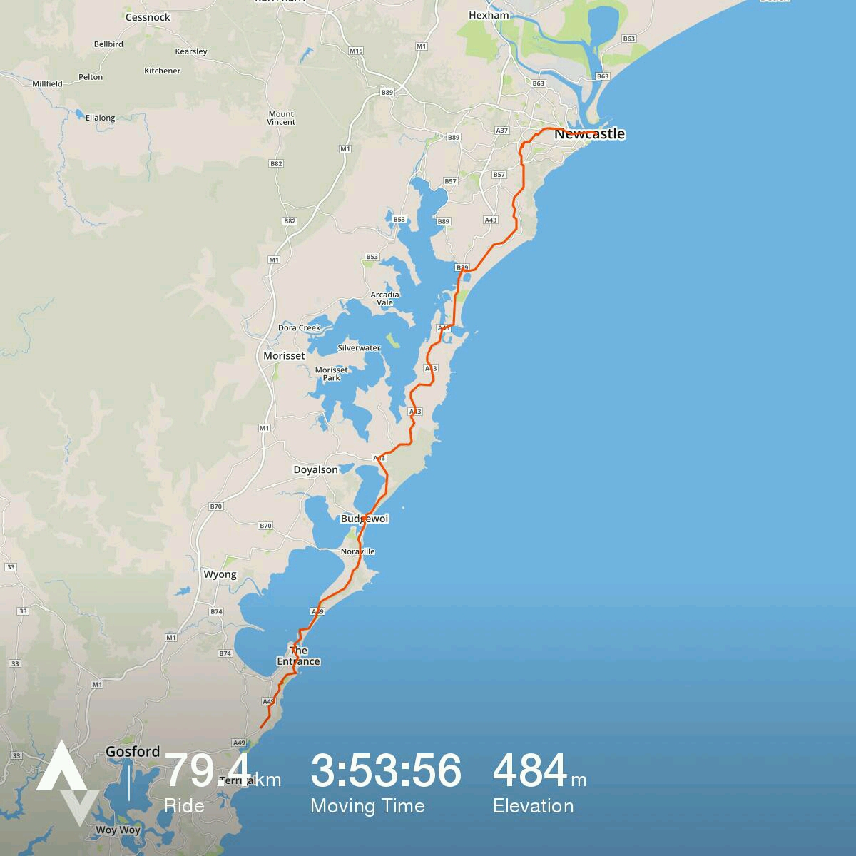
We’ve ridden this route south to north a couple of times, so it was interesting to do it the other way.
Marc figured out what he thought was a pretty flat route out of Newcastle City Centre… so that’s worth following (particularly if your legs are at the end of a trip like ours were!) He was inspired to do this after following a prescribed ride route into Newie on the Sydney to Newcastle Overnight ride last year and deciding that there was definitely a less hilly way to go.
Fernleigh Track is the way to go … and if you want our opinion, it’s easier to do it north to south… feels like the gradient from Adamstown to Whitebridge is a bit kinder – and shorter? – than Belmont to Whitebridge!
Then it’s the Pacific Highway (other than a bit of bike path just north of Swansea)… no escaping it, but at least, south of Swansea, the shoulder is pretty wide.
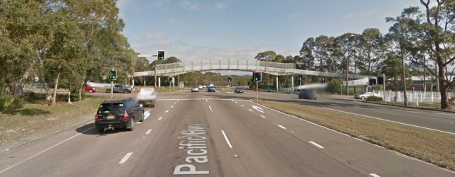
The turn off at Elizabeth Bay Drive isn’t that well signposted… You’d think it would have great big signs for The Entrance but it doesn’t.
Here’s a google streetview cap so you know what to look for if you’re heading south and want to go that way!
If by chance you go the fish and chips option creekside at Budgewoi , (well, it just felt like the right sort of lunch – by the water, you know!)… try the one with the seating. We weren’t impressed with the fish we got from the other fish and chip takeaway.
After The Entrance, our Toowoon Bay/Bateau Bay Rd detour was pretty good… the streets were pretty quiet. Looking at the map, next time I’d give the lake side (through Long Jetty) a go for some nice scenery!
Not much more to suggest for this day… If you’re credit card touring, Forresters Beach resort gets a thumbs up (just ask for a ground floor unit.) We had intended to stay at a motel in Terrigal – we’d stayed at one on a tour several years ago. Turns out it’s closed, and the accommodation choices there are a bit too upmarket! In the end I think that was a good move, as we then were able to ride to Patonga via Gosford and Woy Woy.
We sussed from a couple of shop signs that the locals clearly refer to it as ‘Forries’ Beach… so if you want to blend in… there’s a tip 😀
Also HIGHLY recommend the little Italian restaurant Dolce Vita in the corner shopping complex on the corner of Forresters Beach Rd and the Central Coast Highway.
Link to zoomable strava route map:
https://www.strava.com/activities/714852516/shareable_images/map_based?hl=en-GB&v=1474092378

Pingback: Day 9 – last day – Forresters Beach to Hornsby via Patonga-Bobbin Head ferry (map and notes) – Tandem Tours