
Tuesday 3rd May, 2022
104.8 km +1820m
Moving 6:44, Elapsed 10:11
Max 54.1 kph, Avg 15.6 kph

Today was the day. BOF. Back of Falls. It has kind of built up to having legendary status, for riders, and dotwatchers.
Part of the ‘legend’ is the infamous start of the climb, where you turn sharp left off the Omeo Hwy at ‘WTF corner’ onto Bogong High Plains Rd. Now, some people might say that WTF stands for ‘Way to Falls’, but everyone else knows that it stands for what an unsuspecting cyclist would say upon turning that corner to see the immediate steep incline. Within 100m it hits 9-10%. Bam. WTF?! It’s then 100m to a hairpin bend and you’re at 12%, ramping up to 15.4% at 250m along! (And don’t forget that 0.4!)
The first 5 km averages 9.3%.
And the whole of ‘Back of Falls’ is about 25km of climbing and a gain of 1000m. You then actually drop 200m riding 10km around a dam before reaching Falls Creek itself.
There was always going to be an added degree of difficulty for the tandem (versus single bikes), but this was why Marc had put lower gearing on our tandem.
He also researched the heck out of the climb and broke it up into sections, so that we would have mini-goals.

Anyway. First, we had to get the 40km to WTF corner. (Or 39k as it turned out because the Hilltop Hotel was almost 1km out of town on the way.)
With our ideal plans to have stayed at Anglers Rest (11km from WTF) foiled, we needed to start EARLY.
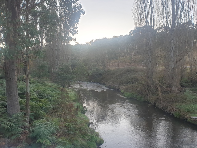
At 5.20am we tippy-toed out of the hotel (as much as you can tippy-toe carrying a tandem bike down creaky stairs!), wearing everything in warm riding gear that we could. It was one and a half hours before sunrise. Within 10km the temperature on the Garmin was registering at zero degrees, so with the wind chill on a moving bike, you can imagine how cold we were feeling. It was also foggy, so that made us damp, and thus colder. And then there was the poor visibility factor!
We stopped for 10 minutes at Anglers Rest to eat a banana, but oh my god, it was FREEZING. From there on, and for the next 11km the temperature dropped to minus 1/minus 2. Our feet and hands were like blocks of ice, with Marc struggling to change gears because his fingers were numb.

I suppose that all had one positive effect. Instead of dreading WTF corner, we were both thinking ‘BRING IT ON! Cannot WAIT to ride uphill and get WARM!!!’
It seems that at the same time, we were also running interference for dotwatchers looking for excuses not to go to work!


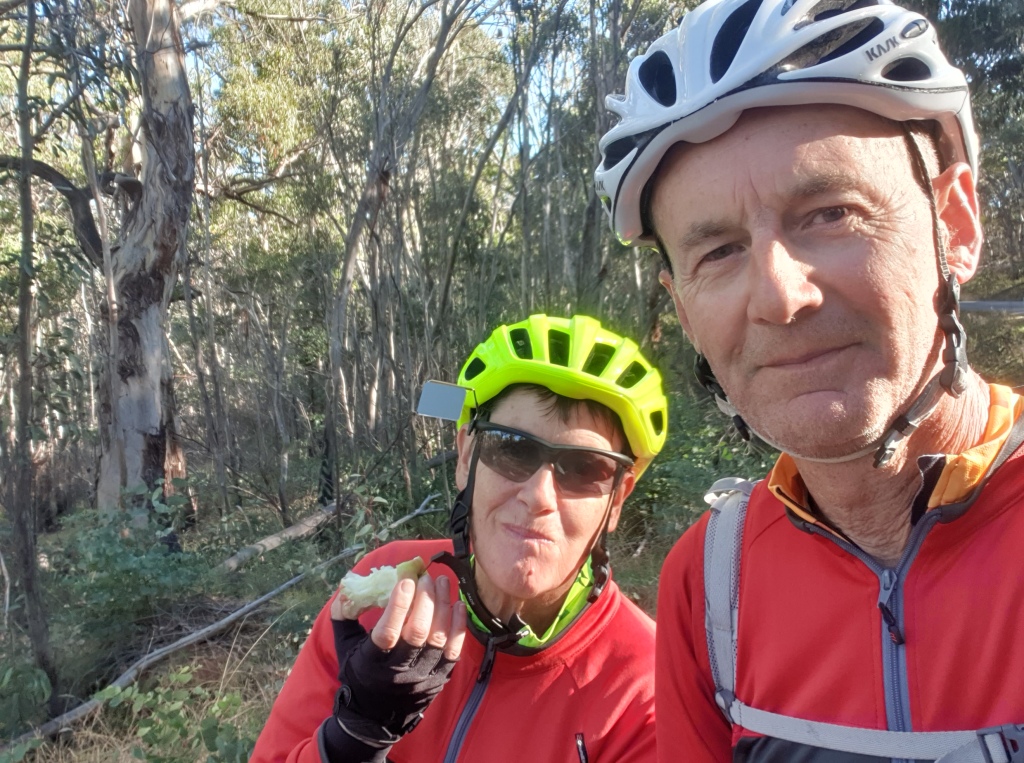
We all but cheered when we got to that bloody Corner, and hooked into it. We were worshipping the sun as we rode up out of that freezer of a valley and the rising sun shone through the trees.
Hilariously, not long into it we needed to stop to strip off our jackets and switch from long to short gloves. We made a few other strategic stops as we ‘conquered’ each section.
We are so thankful that Marc had the replacement Lezyne, courtesy of Malcolm and the Port Augusta Post Office agency pick-up! It was an immediate relief for me back then – as I posted on that day’s Strava summary: “Now he won’t have to keep asking me what the gradient is and then saying the Garmin is stupid anyway”. The Lezyne’s altimeter is also really accurate, so knowing exactly what elevation we were at was really good. It would have been so much harder dealing mentally with these serious climbs without it.

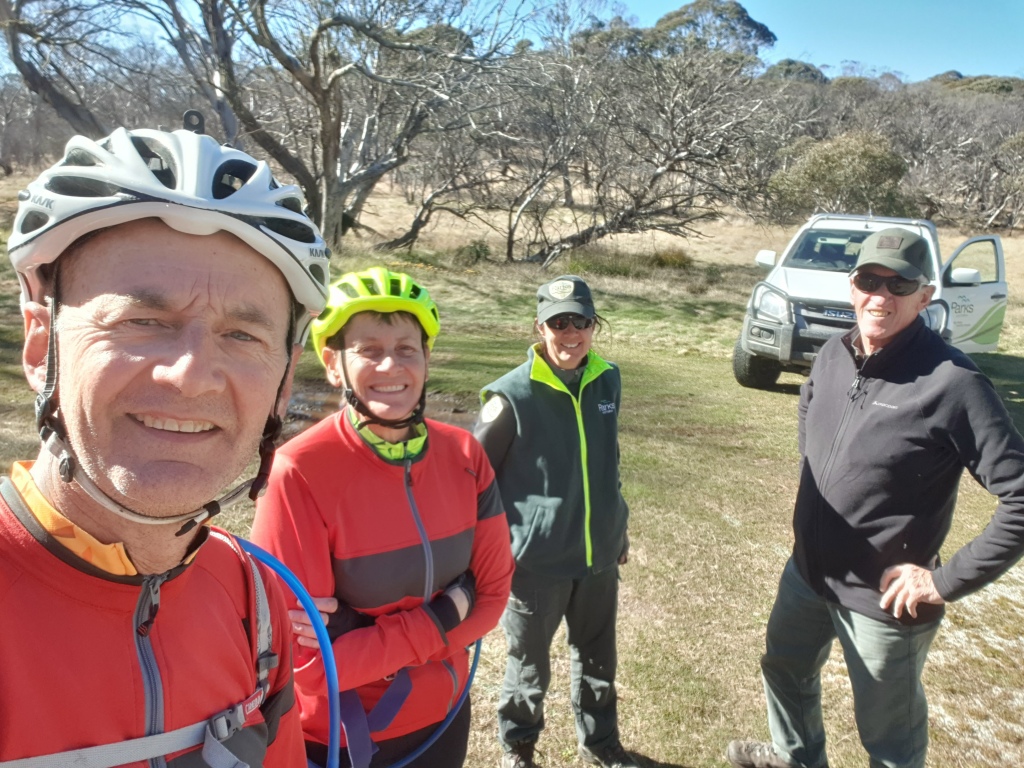
With all the ‘H for hard’ gradients done, we stopped for a break at Buckety Plains. A Parks Victoria vehicle pulled up, and the rangers got out to have a chat with us. They were nice. They both did a bit of cycle touring too.
The nearer the top we got, the more open it got, and we copped the wind.
It took us nearly 3 and a half hours all up from WTF corner to Mt Cope, which is pretty much at the top.

One more short ‘up’, and we were over the highest point. We’d done it. It was then still another 11km down and around the dam till we got to the ski resort town of Falls Creek. Still pre-ski season (fortunately for us, of course!), but thankfully one restaurant/cafe was open.

We had burgers and chips for lunch. And I had coffee. Boy did I need coffee. We’d been there nearly an hour, perhaps, when Marc nudged me and gestured in the direction of a young couple moving away from the counter with coffees in hand, him nudging her. Oh. My. God! We knew them! It was Emily and Jake – the daughter, and, as it turned out, newly-minted son-in-law – of long-time friends of ours. We’ve known Emily since she was born, but we’ve shared canyoning adventures with both of them in more recent years. They were actually on their honeymoon. While they had an idea we might be riding through this area, we had no clue about them. They are into hiking, and would often be camping, but because it was their honeymoon they were living it up in an Airbnb in Bright, and going for day trips and shorter walks.
What were the actual chances of them actually running into us?! We had a bit of catching up to do! And we made a tentative plan to see them again tomorrow morning in Bright if the timing worked out.

We headed off from Falls just after 2.00. It was pretty much all downhill to Mount Beauty – for 30km – and you would think that that would be all yeeha! Nope. It was actually pretty hard on a tandem, and really tough on Marc’s hands. Later Marc had this message exchange with Malcolm (who has been riding single bikes now for far too long – and only rode his tandem, unloaded, with a kid!!)

We got to the motel at 3.30, and, yep – that was more than enough for one day. Not long after we got there we got messages querying if we were ok, as the tracker still had us way back up towards Falls, and off the road (in a gully somewhere) since 2.30. Exactly the kind of situation we were avoiding by going so ‘slow’! The satellite had lost its link with the Spot in the windy (as in winding) gorge, so it was a case of turning it back on and sitting it back outside so it would ping, so as not to have the whole dotwatcher community freaking out.
Mount Beauty was established as a hydro scheme worker town back in 1949 – and it still has that vibe to it. It doesn’t feel or look like you expect from its name – although fair to say we didn’t see much of it. We walked a few hundred metres to the main street to the one and only restaurant – an Indian one.
Now to time our run through to the Cabramurra climb, which despite being a smidgin lower than BOF, is actually more metres in climbing (because it starts the serious climbing from 400m lower than WTF corner.) And after the peak, you’re above 1000m for a lot longer – around 100km in fact! We had no intention of going up there in bad weather, so keeping our eye on the forecast was paramount.
Tomorrow we were headed to Beechworth – around 100km, with two separate climbs.

I have been waiting for this one. You seemed to knock it over with ease. Malcolm is a demon down hills. He just is. I have learned to just sit up, enjoy the view and catch him in the next town that serves craft beer. He’s much slower leaving those.
LikeLiked by 2 people
Haha, the Tracey in that photo disputes the ‘with ease’ appraisal!
LikeLike